PulsePoint Respond
What's new in v4.16 for professional responders
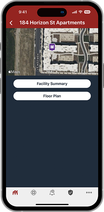
PulsePoint Respond v4.16 adds significant new functionality for Professional Responders, including dispatch notifications based on assignment, hydrant and preplan map layers, dispatch destination imagery, and support for full incident narratives.


Assignment-based Notifications
Hydrant Map Layer
Preplan Map Layer


Destination View


Incident Narrative
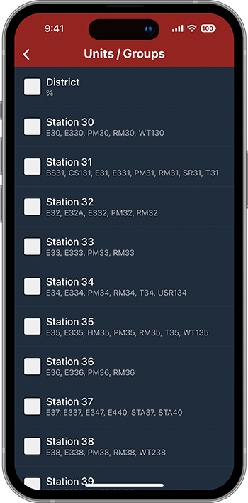
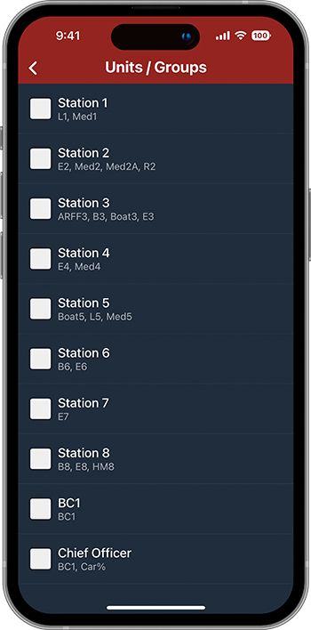
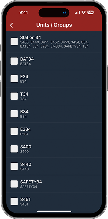
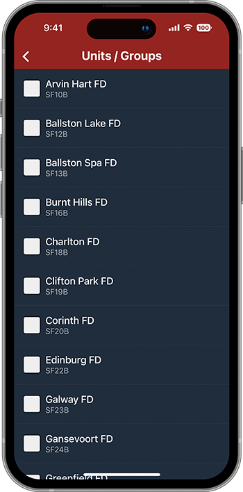
Unit/Group Notifications
On-duty dispatch notifications for all incidents based on assignment
Unit/Group Notifications allow Professional Responders to receive dispatch notifications for all incidents based on assignment, such as station or apparatus (e.g., notify me of all incidents for Engine 31).
Agencies must define unit/group selection options before this feature is available to personnel.


Rogers FD (AR)

UC Davis FD (CA)

Unit/Group Notifications
Group Examples
Agencies can define their notification groups to best meet organizational needs. View the adjacent images for common examples, including notifications by role, unit, or group of units.
Get started by visiting how to use unit/group notifications.
The % sign represents any sequence of characters and may be used to simplify unit definitions (e.g., Car% represents Car1, Car33, Car410...).
Map Layers
Pre-arrival information that turns travel time into strategy time.
v4.16 adds two new map layers for on-duty use - hydrants and preplans.
Agencies must supply hydrant and preplan data to enable this feature.
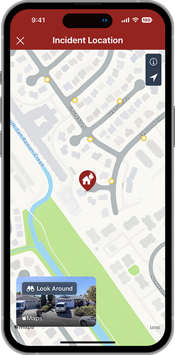


Map Layers
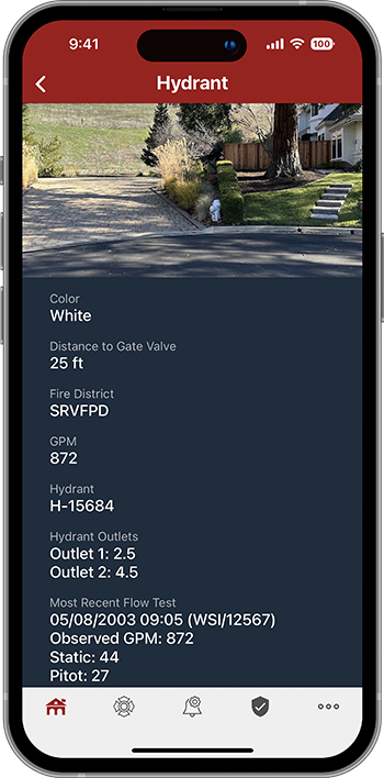
Hydrants
Firefighters can easily display the fire hydrant map layer when responding to incidents that may require a hydrant. Icon colors can be used to indicate expected hydrant performance or to meet other local standards. Taping a hydrant icon displays additional hydrant characteristics, such as flow and outlet configuration, if available.
Map Layers
Preplans
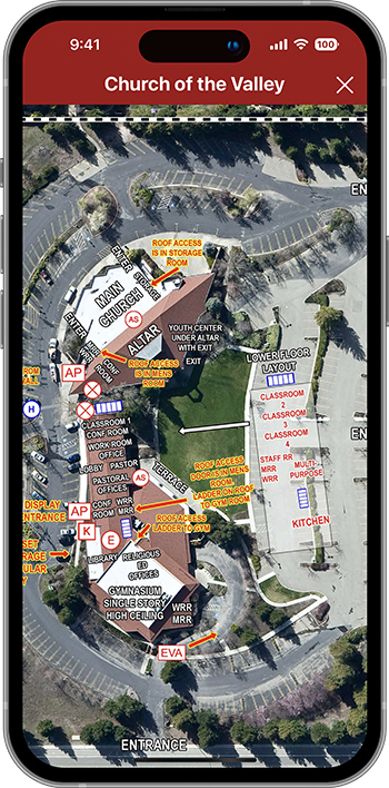
The preplan map layer allows agencies to make existing preplan information effortlessly available to responding personnel. Simply display the preplan layer when access to plan documents may be needed.
Purple preplan icons indicate the presence of a plan. Tap the icon to display the plan.
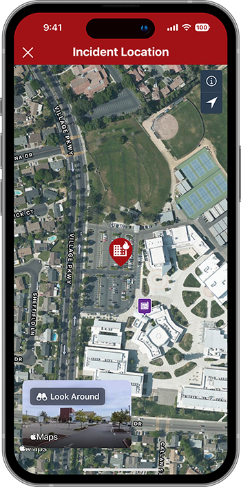


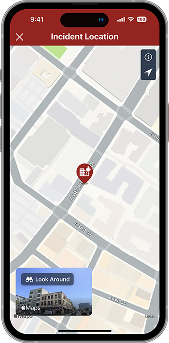
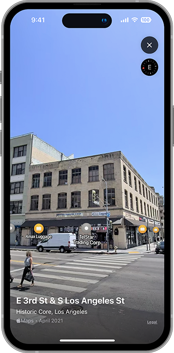
Destination View
Go there before you get there


With Destination View you can view imagery of where you're going before you arrive. Look Around is a technology feature in Apple Maps that provides interactive 360° panoramas of street-level imagery. Our Android version already provides similar functionality with Street View.
Look Around is only available in select cities, but the list continues to grow.
Destination View
Destination imagery
Tap the Look Around thumbnail to view an interactive 360° daytime panorama of the destination address. The imagery can be panned, zoomed, and tilted to determine business or structure type, evaluate exposures, sight utility lines, identify access challenges and generally improve situational awareness while traveling to the scene.
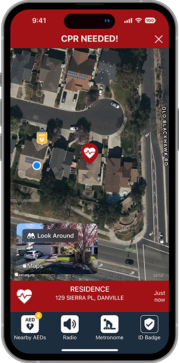
The Destination View thumbnail will also appear on the CPR-needed Alert screen when imagery is available.


Registered CPR Responder / Professional Responder
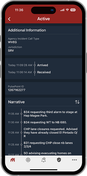
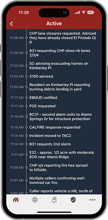
Event Chronology
Know the whole story


The event chronology provides valuable, real-time information that is often unavailable to responding personnel. Incident narratives (i.e., CAD notes) provide unique insight into a progressing event that, when shared, can help provide a common operating picture and improve situational awareness.
Not all dispatch system integrations support this feature.
Event Chronology
Incident narrative
The narrative timeline appears on the incident detail page. It includes all entries from event creation through final disposition and is continually updated in real time.
Reverse the order of the entries by tapping the sort icon (up/down arrow) at the top of the narrative section.


Webinar
v4.16 Pro Feature Webinar
Join the PulsePoint staff for a tour of the new features found in v4.16.